)
.webp)
Spatial Crime Analysis Property Hot Spots: How AI Is Mapping Safer Cities in 2026
Key Takeaways
- AI-Driven Insights: Artificial intelligence enables cities to predict and map crime patterns with high accuracy.
- Hot Spot Identification: Property crimes cluster in specific areas, allowing targeted interventions.
- Data-Driven Urban Planning: Governments use spatial data to design safer and smarter cities.
- Time and Environment Factors: Crime patterns shift based on time, land use, and human activity.
- Ethical Considerations: Fairness and bias remain key concerns in predictive policing systems.
What Is Spatial Crime Analysis Property Hot Spots?
In 2026, spatial crime analysis focuses on understanding where crimes occur and why they concentrate in certain locations. Property crimes such as theft, burglary, and vandalism are rarely random; instead, they form clusters known as hot spots. By using Geographic Information Systems, machine learning, and time-based tracking, analysts can map these clusters across neighborhoods and even individual streets1.
These insights help cities move beyond reactive policing toward proactive prevention. Instead of responding after crimes occur, authorities can anticipate patterns and allocate resources more effectively.
Why This Topic Is Trending in 2026
The rapid advancement of artificial intelligence has transformed spatial crime analysis into a predictive tool. Modern systems can analyze years of historical data to forecast future crime patterns, making urban safety strategies more precise and efficient2.
Cities are increasingly adopting data-driven approaches, integrating crime mapping into broader smart city infrastructures. This allows real-time monitoring alongside traffic, environmental, and population data, creating a holistic view of urban dynamics.
A Closer Look: Malaysia’s Urban Crime Patterns
Malaysia has emerged as a key example of how spatial crime analysis can reveal meaningful insights. Studies show that crime clusters vary significantly depending on factors like income levels, infrastructure, and population density3.
These findings highlight that crime is not evenly distributed. Certain neighborhoods repeatedly experience higher incidents, and some hot spots persist for years, making them critical focus areas for intervention.
)
Spatial distribution of property crime clusters across urban regions showing persistent hot spots over time
This type of visualization allows authorities to better understand long-term patterns and deploy targeted solutions where they are most needed.
The Role of Time: Crime Changes Over Days, Months, and Years
Crime patterns are dynamic and influenced by time. Research shows that property crimes fluctuate based on time of day, seasonal trends, and economic cycles, revealing predictable behavioral patterns4.
Advanced analytical frameworks now combine spatial and temporal data to create evolving maps that track how crime hot spots emerge, shift, or disappear over time5.
Land Use: Why Some Areas Attract More Crime
Land use plays a major role in shaping crime patterns. Commercial zones often attract theft due to high foot traffic, while residential areas may see more burglaries. Mixed-use spaces can experience both due to overlapping activity patterns6.
Urban planners are using these insights to design safer environments by improving lighting, optimizing building layouts, and strategically placing public services to reduce opportunities for crime.
AI Models Behind the Scenes
Artificial intelligence powers the modern evolution of spatial crime analysis. Machine learning models, including random forest algorithms, analyze environmental data such as land cover, infrastructure, and movement patterns to predict high-risk areas.
This approach goes beyond traditional crime mapping by identifying environmental conditions that contribute to crime, enabling more precise and proactive prevention strategies.
Policing Meets Data: Smarter Resource Allocation
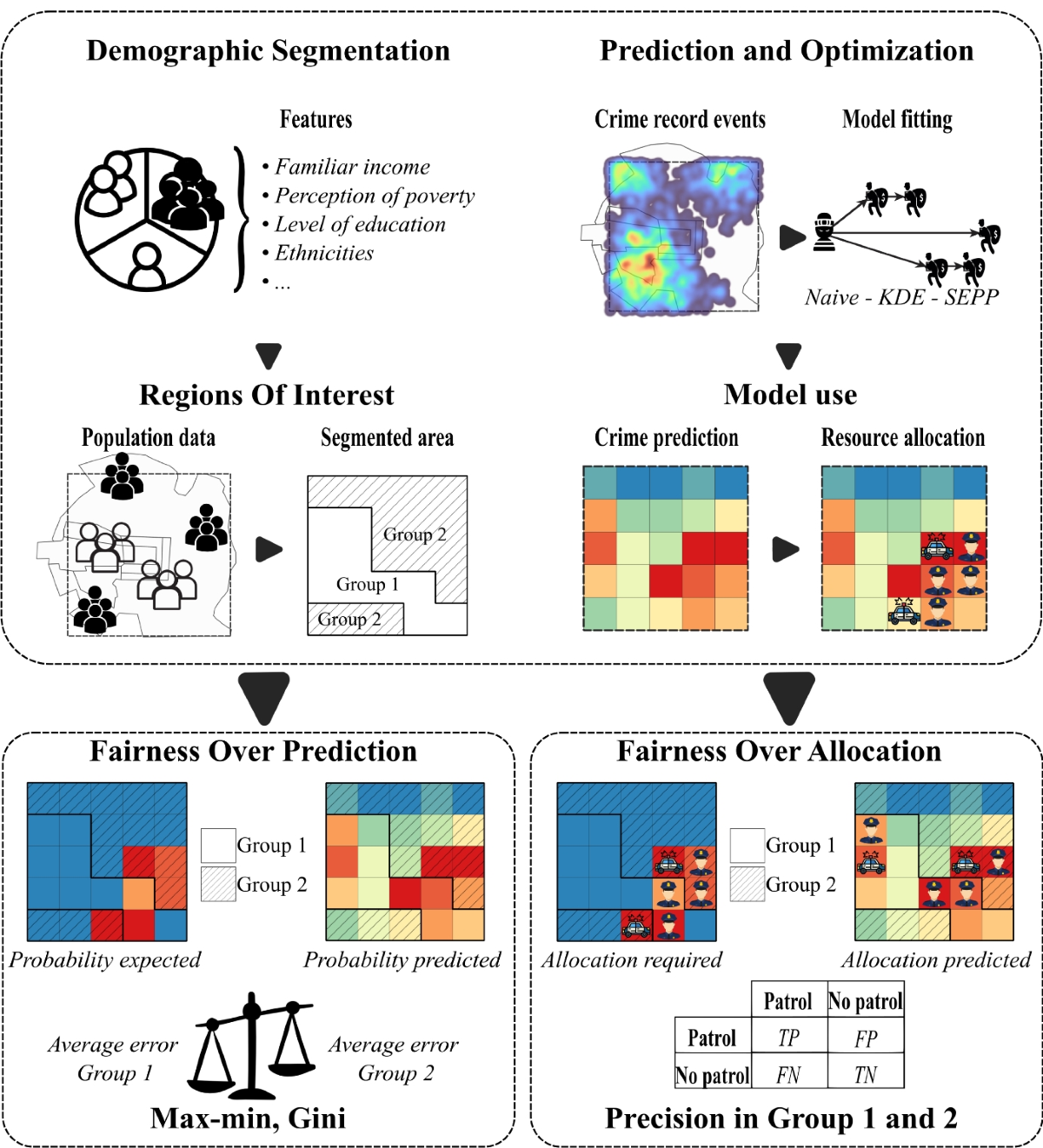
Law enforcement agencies are increasingly using spatial analysis to optimize resource allocation. By focusing on high-risk hot spots, police departments can improve efficiency and response times.
However, concerns about fairness and bias remain significant. Studies highlight that predictive policing systems must be carefully designed to avoid reinforcing existing inequalities7.
A Global Perspective: Lessons from Detroit
Spatial crime analysis extends beyond regional studies. In cities like Detroit, research shows that offenders often specialize in specific types of property crime, adding another layer of predictability to crime patterns8.
Combining behavioral insights with spatial data allows cities to create highly targeted interventions that address both location and offender behavior.
The Academic Backbone: Why Research Matters
Academic research plays a crucial role in advancing spatial crime analysis. Scholars contribute validated methodologies and real-world applications that ensure the accuracy and reliability of predictive models9.
This foundation ensures that AI-driven tools are not only innovative but also grounded in evidence-based practices.
Real-World Impact: Safer Cities Through Smarter Design
Spatial crime analysis is transforming urban living by enabling smarter decision-making. Cities can now proactively design safer neighborhoods, allocate police resources effectively, and guide development planning.
For residents, this means improved safety and better-informed choices when selecting where to live or invest.
Challenges Ahead
Despite its advantages, spatial crime analysis faces several challenges. Data privacy concerns, potential algorithmic bias, and over-reliance on automated systems highlight the need for balanced implementation.
Human oversight remains essential to ensure ethical and fair use of these technologies.
What’s Next for Spatial Crime Analysis?
The future of spatial crime analysis points toward real-time predictive systems integrated with smart city infrastructure. Advances in AI will continue to improve transparency, fairness, and accuracy.
As technology evolves, cities will gain even greater capabilities to anticipate and prevent crime before it occurs.
Final Thoughts
Spatial Crime Analysis Property Hot Spots represents a major shift in how cities approach public safety. By combining artificial intelligence, spatial data, and human insight, urban areas are becoming more proactive, efficient, and secure.
The result is a future where safer cities are not just an aspiration, but a data-driven reality.
Frequently Asked Questions
Question: What is spatial crime analysis?
Answer: Spatial crime analysis is a method of studying where crimes occur and identifying patterns or clusters to understand and prevent criminal activity.
Question: How does AI help in predicting crime hot spots?
Answer: AI analyzes historical data, environmental factors, and time-based trends to forecast where crimes are likely to happen, enabling proactive interventions.
Question: Why do property crimes cluster in specific areas?
Answer: Property crimes cluster due to factors like land use, population density, visibility, and opportunities created by human movement and infrastructure.
Disclaimer: The information is provided for general information only. BridgeProperties makes no representations or warranties in relation to the information, including but not limited to any representation or warranty as to the fitness for any particular purpose of the information to the fullest extent permitted by law. While every effort has been made to ensure that the information provided in this article is accurate, reliable, and complete as of the time of writing, the information provided in this article should not be relied upon to make any financial, investment, real estate or legal decisions. Additionally, the information should not substitute advice from a trained professional who can take into account your personal facts and circumstances, and we accept no liability if you use the information to form decisions.